Luxulyan
OS Grid ref:-
 Luxulyan is situated around four miles (6.5 km) to the northeast of the town of St Austell and six miles (10 km) south of Bodmin.
The village lies among china clay quarries and numerous small granite domes are dotted around the area. Luxulyanite, a rare and attractive type of Cornish granite is named after the village. A 70 ton piece of this particular granite quarried from Trevanny was used for the tomb of the Duke of Wellington in St Paul's Cathedral.
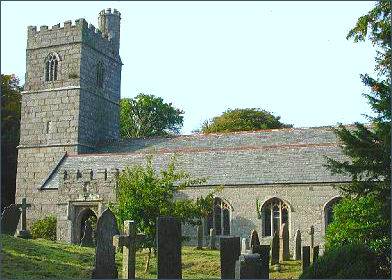
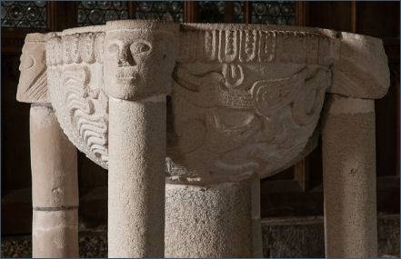
The granite village church of St Ciricius and St Julitta, (pictured left) a grade I listed building, originally dated from the Norman era, but was entirely rebuilt in the fifteenth century. The tower is without buttreses or pinnacles and the south porch has battlements and a handsome tunnel-vault. It still retains its decorated Norman font (right) which dates to the eleventh century.
Near the church is St Cyors' holy well which also dates to the fifteenth century. The well was restored by the Old Cornwall Society in 1945.
 St Sulien, or Sulian, was abbot here during the sixth century. The church in the village may have been dedicated to him originally, but it is now dedicated to Saints Ciricius (Cyr, Cyriacus, Quiricus) and Julitta. Luxulyan, is known in Cornish as Lansulien, meaning 'lann' - sacred enclosure and the name 'Sulgen'.
 There are several crosses in Luxulyan parish. The cross in the churchyard is originally from three stiles near Conce and is made of a local volcanic rock, known as Luxulyanite. There is another at Prideaux. There was a cross at Methrose but it was removed in 1890 and taken to Menabilly. There is a Celtic cross in the private garden of the vicarage.
The granite Methrose farmhouse, the name means 'sweet smelling heathland', probably dates to the early 16th century and "one of the best farmhouses in Cornwall" according to Pevsner. The remains of an Iron-Age hillfort known as Prideaux Castle are located just to the south, near the border with the village of St Blazey.
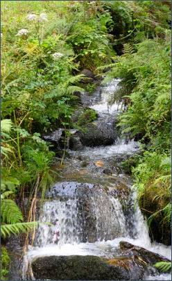
The Luxulyan Valley (left) , a steep sided and thickly wooded stretch of the valley of the River Par that contains a major concentration of early nineteenth century industrial remains, including a combined Aqueduct and Viaduct. The valley was designated a World Heritage Site in 2006.
The valleys mining heritage represents principally the physical manifestation of one mans vision Joseph Treffry (1782-1850) to exploit the valleys mineral resources. Remains include the Treffry Viaduct, granite mine buildings and the later 20th century concrete structures, leats, tramways, mineshafts, adits and an impressive waterwheel pit. Significantly, both copper mining and then the later china clay processing industry are represented side-by-side.