Dodman Point
OS grid reference :- SX 001 393
 Dodman Point is situated near to the villages of Mevagissey and Gorran Haven, on Cornwall's beautiful Roseland Peninsula.
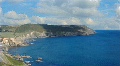
The Dodman, as it is otherwise known, is the highest headland on the south Cornish coast, rising to 400 feet (120 metres) high. On a clear day there are superb views in all directions from Dodman Point and in spring and summer the coastal grasslands are covered with colourful wildflowers. Offering spectacular views, the area is also of archaeological interest.
 The headland, which was originally known as the Deadman or Deadman's Point, is enclosed by a huge earthwork, which dates back to the period of the Iron Age. The massive earthwork measures nearly 666 metres long, stretching from the cliffs on the west coast to those in the east and was designed to defend the tip of the peninsula., It is over 6 metres in height in places and probably housed a series of dwellings, known collectively as a promontory fort or cliff castle.
Prehistoric remains include Bronze Age barrows, as well as medieval field systems.The Bulwark earthwork provides a circular footpath around the Dodman, connecting to the South West Coast Path.
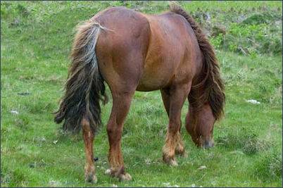
The National Trust have introduced Dexter cattle and Dartmoor ponies to graze Dodman Point, to reduce the coarse scrub and enable more delicate species to flourish on the headland, as well as to keep the archeological sites from becoming overgrown.As a result, In springtime and summer the martime grasslands around the point are brimming with wildflowers.
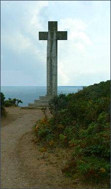
A large, granite cross stands on Dodman Point, which is visible from several miles away, it was erected in 1896 by Rev. G Martin as a navigational aid for sailors. Below the cross, there is a way down to the bottom of the cliffs.
A late eighteenth century watch house, built during the Napoleonic wars, also stands on the Dodman, a survivor of what was a chain of Admiralty signal stations set up to alert the Navy of any untoward shipping movements in the Channel. The watch house was built on an 1588 Armada beacon site.
A walk to Dodman Point
Distance - 4.7 miles (7.6km)
Duration- around 3 hours
(1) Commencing at Penare car park, near Gorran Haven (OS grid ref: SW999404). Exit the car park, cross the road and climb steps to join the path. Turn right, following the finger post which is signed 'Hemmick Beach 1/4 mile'. Ascend the steps, pass through the gate and follow the path alongside the fence.
 (2) As Hemmick beach comes into view, bear left and follow the path traversing the slope.
Bear left to join the South West Coast Path, and head uphill keeping the fence line and sea on your right-hand side.
Go through the kissing gate and continue on the coast path by walking along the right-hand side of the field, following the fence line.
(2) As Hemmick beach comes into view, bear left and follow the path traversing the slope.
Bear left to join the South West Coast Path, and head uphill keeping the fence line and sea on your right-hand side.
Go through the kissing gate and continue on the coast path by walking along the right-hand side of the field, following the fence line.
(3) Pass through the kissing gate to continue on the coastal path to meet the eastern side of the Bulwark and remain on the coast path, signed 'Vault Beach' and 'Gorran Haven'. Pass through the kissing gate above Vault beach and follow the lower path into Gorran Haven.
(4) On reaching Gorran Haven turn immediately left, up a steep minor road, Foxhole Lane. At the top of Foxhole Lane , continue up hill a little further, going past Lamledra National Trust car park. Following the narrow minor road, go through the metal field gate onto The Gruda.
(5) Immediately before the next metal field gate that crosses this road, turn left to climb over the stone steps stile. The path then runs diagonally across the field. Climb a further stone stile and the last section of the field, where a wooden stile brings you back onto the road at Penare. Bear left to walk through Penare and return to the car park.