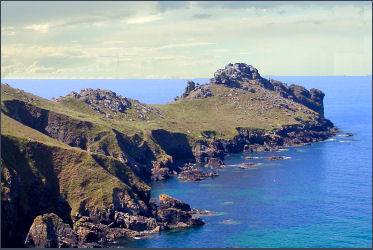
Gurnard's Head
OS grid ref:- SW 432 386
Gurnard's Head is a long, narrow, headland near the villages of Treen and Zennor, on the northern coast of the Penwith peninsula,.
The name derives from the shape of the headland which is supposed to resemble the head of the Gurnard fish. The headland is known in Cornish 'Ynyal', which translates as 'desolate one'.
Trereen Dinas
The headland is the site of an Iron Age promontory fort known as Trereen Dinas, not to be confused by the Iron Age promontary fort of Treryn Dinas or Treen Castle which is situated on a narrow granite headland between Penberth Cove and Porthcurno.
There are two stone ramparts at Trereen Dinas, each measuring around sixty metres long, cross the narrowest part of the headland forming the cliff castle. The ramparts enclose an area of about three hectares where the remains of sixteen roundhouses have been discovered averaging six meters in diameter.
An excavation carried out in April 1939 under the direction of Miss A.S.R. Gordon revealed that the back of the inner rampart had been constructed in three steps, providing a place for slingers to stand. The promontory defences are generally fairly hard to make out, although it is possible to discern the remains of the walls. The original entrance is now filled up and not evident on the surface, although a modern path runs over it. There were a few small finds, including fragments of an iron knife (domestic) iron buckle, spindle whorls, rubbing stone and pottery sherds, were unearthed. Evidence points to a date before the middle of the second century B.C. is likely for the initial occupation of Gurnard's Head.
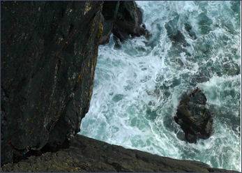
The area is owned by the National Trust, and the cliff castle is on open access land just off the coast path.